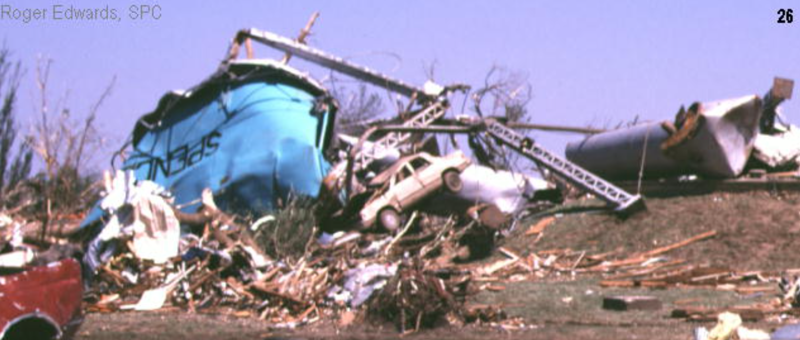
The Spencer F4
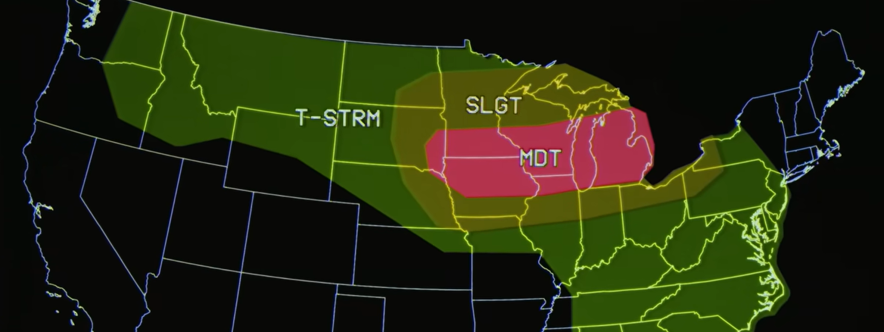
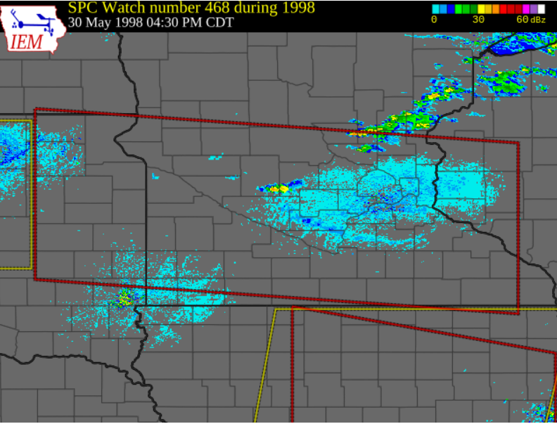
The day 1 outlook for the 30th of may 1998.
(Outlook image made by Weatherbox)
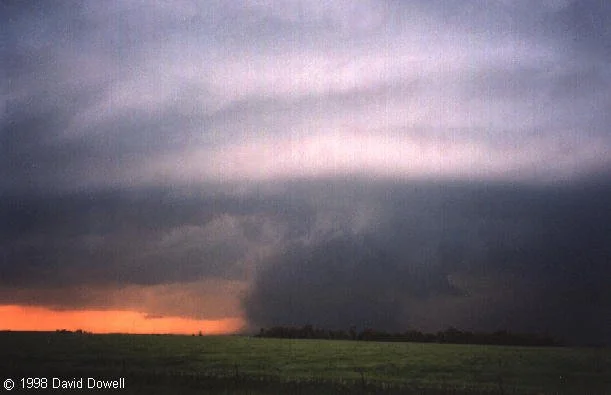
The Fulton F2 in it’s mature stage.
(Picture taken by David Dowell)
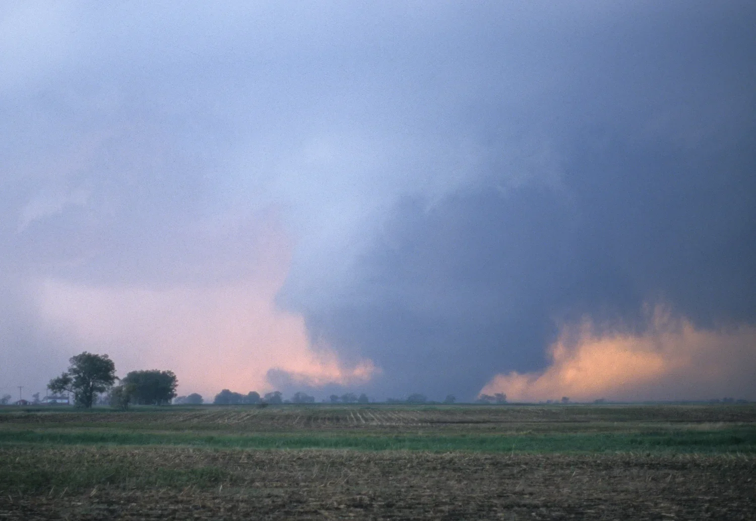
The Spencer F4 right before hitting town. (Image taken by William T Reid)
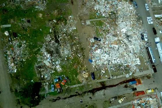
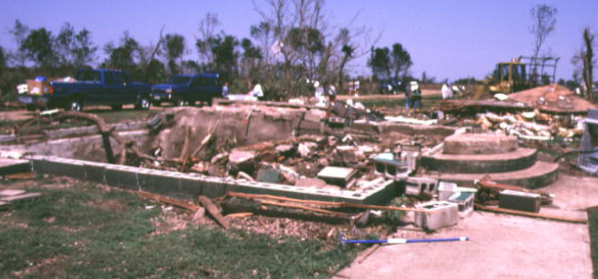
The apartment complex and surrounding buildings completely obliterated.
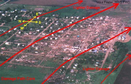
Image taken from a helicopter in Spencer.
May 30th, 1998, the forecasters at the SPC are becoming worried at a potential severe weather outbreak. The main threat for the day was wide spread damaging winds with a potential for a derecho, but a conditional tornado threat was in play in SE South Dakota mainly form prefrontal cells. The first tornado watch of the day was issued at 3:50pm local time, it spanned from eastern South Dakota to extreme western Wisconsin. At 6:35 pm the first cells of the day fired off near Huron SD these cells would later produce the Spencer F4. The first warning for the spencer storm would be issued at 6:55 pm for the threat of damaging winds and large hail. At 7:26 pm the Spencer cell underwent a left split, the storm that split from the Spencer cell shortly dissipated afterwards. At 8:01 pm a funnel cloud reported from the police department prompted the NWS in Sioux Falls SD to issue a tornado warning. The first tornado from the cell touched down at around 8:08 pm near the town of Fulton SD it was a mostly uncondensed dusty tornado that hit nothing for its 2 mile life it was rated F1 Injuring and killing no one. Shortly after the Fulton F1 dissipated the storm cycled and the much stronger Fulton F2 touched down at 8:16 pm. The Fulton F2 was on the ground in mostly rural areas although it did cause minor structural damage. Thankfully the tornado killed and injured 0. The main event of the day would be created by the main line of thunderstorms interacting with the spencer cell, this interaction would give the cell the extra push it needed to produce a truly violent tornado. At 8:23 pm the tornado touched down near farmer SD it hit 5 farmsteads at f2 causing major roof damage and downing powerlines. The tornado now moving dew-east was rapidly approaching town, a SE shift saved town center but sadly putting elderly housing in its path. The first home to be destroyed was a mile west of Spencer, the NWS noted that it had a concrete block foundation and little to no anchoring leading to the F3 rating of the house. The first home to be impacted in Spencer was a small wood frame home that was completely swept of its foundation with no anchoring it stood no chance. Then at peak intensity it slammed into an apartment complex killing 5 of the residents, only a couple of the walls of the bottom floor were left standing. The tornadoes core would then hit the fire station and water tower, the fire station was leveled and fire trucks were flung into near by houses, the water tower was toppled and slightly mangled. The core making its way out of town hit one last home another wood frame house was leveled and windrowed out of town. Leaving Spencer it took another sharp SE turn crossing route 36 much weaker than before and finally lifting 5 miles later. After the event the DOW team came out with their findings, they found 264mph winds were observed in the tornado right before hitting town. The winds measured were above ground level so it wasn’t use in the final rating of F4. 90% of the town was gone, 6 were dead 153 were injured, but the town wanted to rebuild. “We will rebuild!” Bill Janklow (SD Governor) Although the town is a shell of its former self with half the population it had before the tornado, but it still stands today with a new water tower, fire department, a new apartment complex, and a plaque to remember the victims lost on may 30th 1998.
Sources used
The first tornado watch of the day.
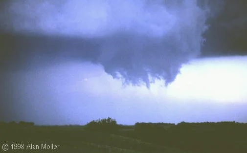
The mesocyclone just after the Fulton F1 lifted and right before the Fulton F2 touched down. (Picture taken by Alan Moller)
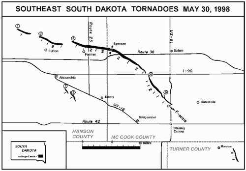
A map of the tornadoes caused by the Spencer supercell.
A poorly built home annihilated a little west of Spencer.
The Spencer water tower toppled over and mangled.
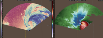
One of the DOW scans from the Spencer tornado.
https://storymaps.arcgis.com/stories/1670e2eb6233419084848cf5def4c8d2 https://www.argusleader.com/story/news/crime/2018/05/30/spencer-south-dakota-tornado-f-4-archives/655394002/
https://www.tornadotalk.com/spencer-sd-f4-tornado-may-30-1998/
https://journals.ametsSpencer, SD F4 Tornado – May 30, 1998oc.org/view/journals/mwre/133/1/mwr-2856.1.xml
https://www.reddit.com/r/tornado/comments/1o47uuh/1998_spencer_sd_tornado/
https://www.weather.gov/media/publications/assessments/spencertornado98.pdf
https://www.youtube.com/watch?v=7yaz-gFKHcI
https://stormbruiser.com/chase/1998/05/30/may-30-1998-spencer-sd-tornado/
https://www.weather.gov/fsd/tor1998may30_pictures
https://x.com/weather_history/status/1928436238173778386